California Condor
Gymnogyps californianus
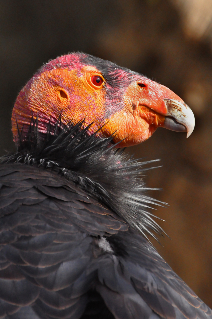 Photo: Ivan Parr
Introduction
Status
Ecological Requirements
Monterey County Regions: Big Sur Coastline, Gablian Range and Pinnacles National Park, but fly throughout the modeled suitable habitat.
Monterey County Natural Communities: Closed-Cone Pine-Cypress, Montane Hardwood, Coastal Scrub, Rocky Outcroppings (USFWS 1996)
Nesting habitat: Nests in cavities on steep rock formations or in the burned-out hollows of old-growth conifers (USFWS 2013)
Foraging habitat: Includes open terrain of foothill grasslands, chaparral, or oak savannah, and open terrain at coastal sites; an obligate scavenger that takes wide-ranging foraging flights (USFWS 1996, 2013). Requires sustainable native ungulate populations as a prey base (USFWS 1996).
Roosting habitat: Located throughout an individual’s range near feeding sites on ridgelines, rocky outcrops, steep canyons, and in tall trees or snags near nesting areas and foraging habitat (USFWS 1996, 2013)
Susceptible to mortality from lead poisoning, ingestion of microtrash, impacts at wind power facilities, wildfire, eggshell thinning, and electrocutions (USFWS 2013, 2018)
Full species account available: California Condor (Gymnogyps californiaus) 5-Year Review: Summary and Evaluation (USFWS 2013)
RCIS Conservation Priority: High (widespread in RCIS area, represents most of species population)
Associated Non-Focal Species
Range and Modeled Habitat
Climate Change Vulnerability Assessment
Gardali et al. (2012) conducted a species-specific climate change vulnerability assessment for the California condor (CACO) on exposure and sensitivity factors:
Exposure Factors
· Extreme weather-Moderate
· Habitat suitability-Low
· Food availability- Low
Sensitivity Factors
· Habitat specialization-High
· Dispersal ability- Low
· Physiological tolerances-Low
· Migratory status- Low
The California condor only uses specific habitat types and is projected to be moderately exposed to more frequent or severe weather events. The U.S. Fish and Wildlife Service 5-Year Review (2013) predicted possible future climate change impacts. The prevailing winds that California condors rely on for soaring may or may not be affected by changing climate conditions. It is possible that large ungulate populations and ranching operations, as well as a variety of other wildlife (e.g., small mammals, pigs, coyotes), that provide food sources may be negatively affected. An increase in wildfire frequency has the potential to destroy roosting sites and cause direct mortality, and hotter summer temperatures and a smaller snowpack may reduce water availability. The U.S. Fish and Wildlife Service (2013) did note that California condors have a very wide historical range, from the Pacific Northwest to the southwest desert, which indicates an ability to adapt to a broad range of climatic and habitat scenarios.
The goals, objectives, and actions aim to protect, enhance, and restore present day suitable habitats for California condor, as well as habitats that may become suitable in the future because of projected climate changes. Actions also address population stability, such as microtrash removal programs and promoting non-lead ammunition, which may allow individuals to move to newly suitable habitats in the future.
Conservation Strategies
California Condor Goals, Objectives, and Actions
There are 30 proposed actions. For complete goals, objectives and actions explanations see the complete table of conservation strategies in the RCIS PDF.
Species Goals, Objectives, and Actions
Goal CACO 1
Increase and promote a self-sustaining California condor population in the RCIS area through protection, restoration, and enhancement of habitatObjective CACO 1.2
Enhance occupied and suitable California condor breeding, roosting, and foraging habitat. Measure progress towards achieving this objective by acres of habitat and adjacent/equivalent acres enhanced and occupied by California condorsAction CACO 1.2.1
Maintain sustainable native ungulate populations to sustain the native prey base for California condor, by native ungulate reintroduction in historical foraging habitats (USFWS 1996). Ensure healthy population of other prey species (e.g., small mammals, coyotes).
Action CACO 1.2.2
Enhance wildfire resilience of habitat near roosting and breeding sites.
Action CACO 1.2.3
Assist the Ventana Wildlife Society with their lead outreach program.
Objective CACO 1.3
Restore occupied and suitable California condor breeding, roosting, and foraging habitat and create new habitat. Measure progress towards achieving this objective by acres of habitat and adjacent/equivalent acres restored or created and/or occupied by California condors.Action CACO 1.3.1
Restore foraging habitat and roosting habitat adjacent to breeding locations. Restore breeding habitat adjacent to foraging and roosting locations.
Goal CACO 2
Support stability and recovery of California condor populations in the RCIS area through measures to reduce direct mortality factors.Objective CACO 2.1
Reduce contaminant-related mortality factors. Measure progress towards achieving this objective by the reduction of contaminant-related California condor deaths detected compared to present day (USFWS 1996).Action CACO 2.1.1
Promote the use of high-quality copper ammunition and promote, including by supporting programs that provide non-lead ammunition (USFWS 2018).
Action CACO 2.1.2
Reduce presence of microtrash in foraging and nesting habitats at sites, such as roadside pullout or overlooks, through surveys and community outreach and clean-up days (USFWS 2013).
Objective CACO 2.2
Reduce impact-related mortality factors. Measure progress towards achieving this objective by the reduction of impact-related California condor deaths detected compare to present day.Action CACO 2.2.1
Where feasible, relocate power lines underground or encase them in insulated tree wire in areas with high numbers of California condor collisions and electrocutions (USFWS 2018).
Action CACO 2.2.2
Implement recommendations by the U.S. Fish and Wildlife Service California Condor Wind Energy Working Group to minimize the potential of collisions at wind energy sites throughout all suitable habitat areas, including locations that condors soar across (such as the Salinas Valley).
Action CACO 2.2.3
Install deterrence implements on power transmission towers, etc., to reduce the likelihood such structures are used as roosting sites by California condors (USFWS 2018).
Action CACO 2.2.4
Implement recommendations by the U.S. Fish and Wildlife Service California Condor Wind Energy Working Group to minimize the potential of collisions at wind energy sites.
Regional Goals, Objectives, and Actions
Goal RC 1
Sustain resilient, connected natural communities for the full range of native species, habitats, and ecological functions in the RCIS area through the protection of large blocks of continuous habitat supporting sensitive species.Objective RC 1.1
Protect and preserve existing intact non-marine habitats and resources and allow for expansion of habitat by protecting suitable or occupied habitat. Measure progress towards achieving this objective by the number of acres of habitat and adjacent/associated acres protected.Action RC 1.1.1
Acquire parcels with suitable habitat through fee title purchase or conservation easement.
Action RC 1.1.2
Conduct surveys using eDNA and/or traditional survey methods in suitable or potentially suitable habitat to locate undocumented occurrences of focal species and other conservation elements and opportunities for habitat protection, enhancement, restoration, and creation (USFWS 2008).
Action RC 1.1.3
Create and sustain long-term funding for protected areas maintenance.
Action RC 1.1.4
Establish an incentive program for private landowners to protect occurrences and manage habitat.
Action RC 1.1.5
Protect populations from impacts from construction, vegetation management, and/or activities, including by surveying areas such as roads/trails and implementing species protection measures.
Objective RC 1.2
Enhance occupied and suitable habitat. Measure progress towards achieving this objective by number of acres of habitat enhanced and/or occupied.Action RC 1.2.1
Manage current and future recreation access including off-road vehicles, biking, equestrian, foot traffic, and unleashed pets to reduce impacts and disturbance to sensitive species and habitats. Ensure recreation is compatible with suitable and future potentially suitable habitat and adjacent areas, and areas of known occurrences. Enforcement and fencing may be used to prevent illegal off-road vehicle use (USFWS 2010).
Action RC 1.2.10
Work with private landowners and stakeholders to research species biology, threats, populations, densities, and/or ranges.
Action RC 1.2.11
Create/enhance connections between ecologically required habitat types, such as between aquatic breeding and upland dispersal habitats.
Action RC 1.2.2
Control non-native invasive species from occupied and/or suitable habitat, and areas designated by the U.S. Fish and Wildlife Service as critical habitat throughout the RCIS area.
Action RC 1.2.3
Reduce/eliminate pesticide, rodenticide (especially first- and second-generation anticoagulant rodenticides), and herbicide use, including for roadside vegetation removal projects as part of integrated pest management efforts in identified suitable habitat, and sensitive natural communities. Promote alternative pest reduction methods, such as promoting natural predator populations (Ventura County Public Works Agency 2017).
Action RC 1.2.4
Minimize impacts from native and non-native predator populations that have increased due to anthropogenic factors, including through educational outreach and trainings on how to safely coexist with native predators and predator removal programs where appropriate.
Action RC 1.2.5
Reduce anthropogenic impacts on habitat, including infrastructure construction and maintenance, inappropriate grazing, uncontrolled grazing, or overgrazing, off-road vehicles, foot traffic, fire suppression, recreational development and activities, non-native plants, and sand mining
Action RC 1.2.6
Manage infrastructure construction and maintenance projects, including transportation, solar energy facilities and projects on military properties, to be compatible for sensitive species.
Action RC 1.2.7
Manage grazing, including the installation of wildlife-friendly fencing, to ensure it is compatible with suitable and future potentially suitable habitat and adjacent areas, and areas of known occurrences. Grazing in sensitive natural communities, public lands should be reduced.
Action RC 1.2.8
Reduce trash dumping in areas with suitable and future potentially suitable habitat and adjacent areas, and areas of known occurrences.
Action RC 1.2.9
Enhance and restore native vegetation in occupied habitat and suitable but unoccupied habitat.
Goal RC 2
Promote persistence of species and important natural communities through the establishment and improvement of habitat connectivity in the RCIS area.Objective RC 2.1
Establish and improve habitat connectivity between large blocks of suitable habitat. Measure progress towards achieving this objective by the number of improved connectivity corridors used by sensitive species.Action RC 2.1.1
Install, repair, and improve infrastructure, such as adding large culverts, under crossings, overcrossings, bridges, directional fencing, scuppers, barrier breaks, roadside animal detection systems, sound barriers, limiting lighting at constructed or natural linkages and remove existing barriers to promote wildlife movement and reduce road mortality (Yap and Rose 2019). Focus on areas with high numbers of vehicle-related mortality, areas with high Area of Conservation Emphasis Terrestrial Connectivity rankings and include areas to create corridor redundancy.
Action RC 2.1.2
Enhance habitat on either side of crossing structures, including protecting adjacent areas, restricting human activity nearby, etc.
Action RC 2.1.3
Create and sustain long-term funding for long-term management of crossings, including acquisition and maintenance of adjacent habitat where suitable.
Action RC 2.1.4
Work with transportation districts or others to collect and analyze roadkill data to identify hotspots where mortality occurs to inform the design of wildlife crossing infrastructure improvements (Yap and Rose 2019).